Newbigging Drainage Adoption & New Housing Development Drainage
Our client applied to Scottish water to have an existing foul sewer that had been laid through his land, adopted. Part of the application process was to provide details of the existing sewer. The existing sewer ran through fields that the client had considered obtaining permission for a housing development. With both in mind the client asked us to carry out an aerial survey.
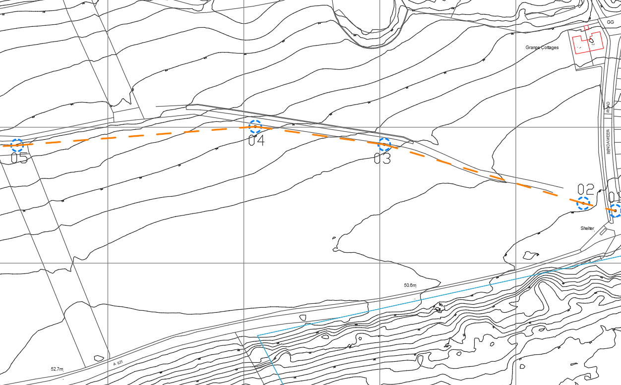
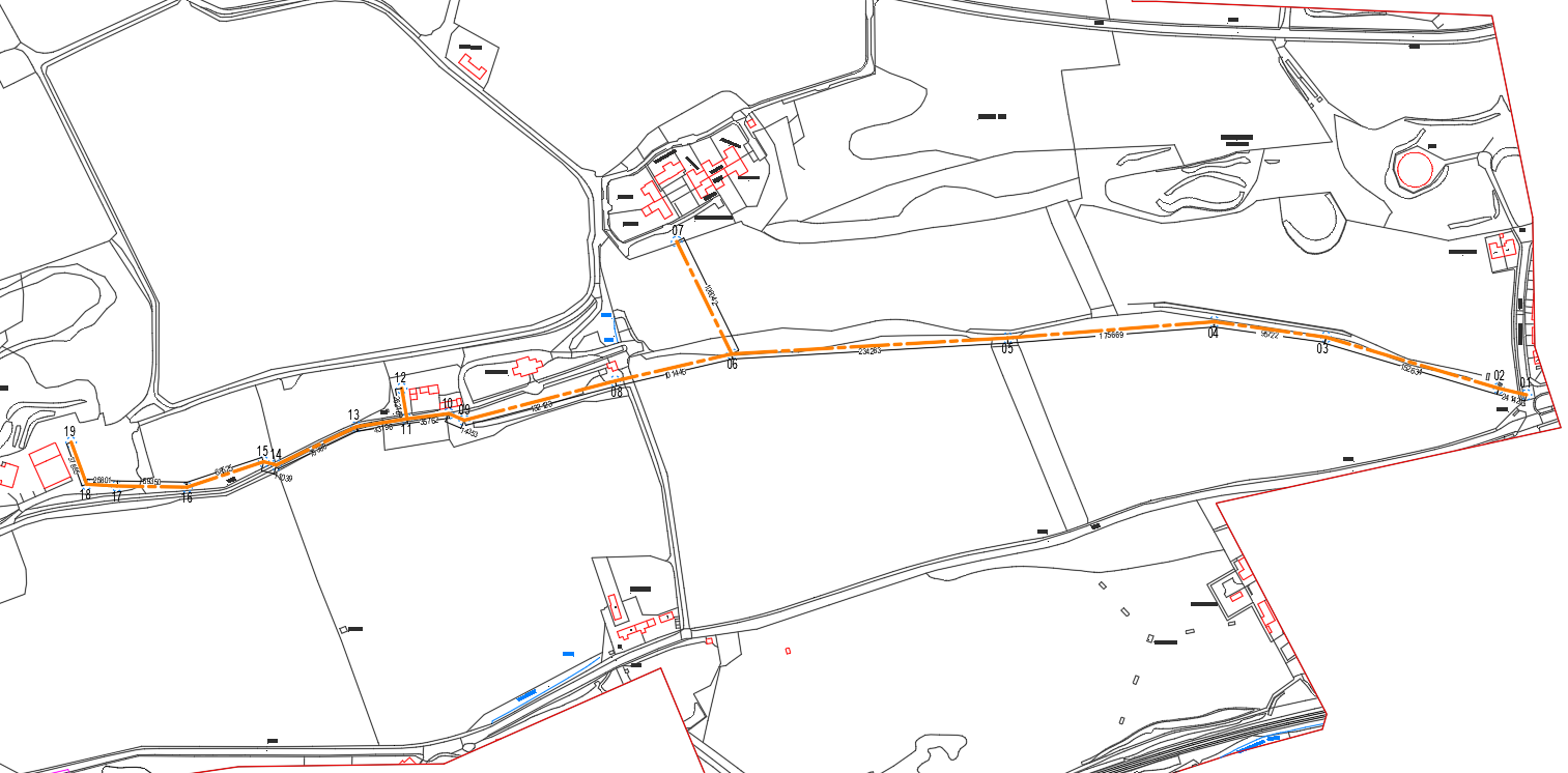
For the sewer adoption we were able to provide mapping with topography, the mapping annotated the existing line of the foul sewer and it’s manholes, with cover and invert levels along with manhole GPS coordinates. We provided the client a .dwg file for their records and provided .pdf files for the client to submit along with their application to Scottish Water.
The Client had considered developing two fields that they owned, initial interest from housing developers encouraged the clients to look into the permissions closer, one issue that the client wanted ironed out was the proposed drainage for the new development, from our processed point cloud we asked a visualisation company to look at the whole site and provide the client with infrastructure details

The above image shows a topographical map of Newbigging, this was surveyed over one and a half days by one of our RTK drones, walking an area this size would have taken over two weeks to survey by stick. From our aerial survey we were able to produce various topography maps at different increments for our client. Through the site ran an unadopted drainage line that the client had applied to Scottish water to have the sewar adopted, we were asked if we could plot the line of the existing drainage that the client had previously run through their land, we provided I.L & C.L along with coordinates for each manhole cover, this information was then annotated to the Topography drawing and on the Orthomosaic image. The client was also looking in to the feasibility of a housing development within a portion of their land, the point cloud from the same survey was then able to be used within visualisation software to produce a proposed site layout plan, along with infrastructure, soft and hard landscaping to accompany a planning application and marketing purposes.
Images of the project