SCOTTISH ENTERPRISE
DRONE SERVICES
Benefits of Drone Surveys
- Safe
- Efficient
- Accurate
- Wide range of output formats
- Unique aerial footage
The list goes on. Find out what we can
provide to you or your project today.
Welcome
We are specialists in aerial video and photography. Our expert drone pilots pride themselves on providing reliable data that is of the highest quality to both business and private clients alike. From a simple photo or map to a complex point cloud, we’re sure we can assist you with your project
What We Do
From our well-appointed offices, we can cover a larger area of the UK, offering a wide range of services to suit the individual needs of each project that we undertake. Our pilots are fully qualified and have a wealth of experience in both the drone industry as well as planning and construction, when it comes to capturing client data no one has the knowledge or experience that we do.
Prior to the commencement of each job that we undertake, we will carry out a full and detailed risk assessment to ensure that your safety is never compromised.
Through innovation, commitment and keeping up to date with the latest technology, we are able to continue to develop new ways to utilise our enterprise aerial drones and demonstrate how efficient they can be and how they greatly reduce any potential safety concerns for employees by using aerial drones for surveys and inspections. By monitoring your assets, this will allow vital maintenance to be carried out and minimizing down time.
Going The Extra Mile
Our goal with every project, is to capture data and content beyond what other companies can offer. We believe in going the extra mile to ensure that the data that we capture is the very best that it can be.
As a smaller independent company, we understand just how important customer service is, and we treat all of our clients, from large companies to individuals, with the same courtesy. You can be assured that you will only receive the highest level of service from SR Aerial Drone Services. Your files will be delivered on time and at a rate that is highly competitive.
So why not get in touch to see what we could do for you?
We contacted Scott and requested his help with identifying the extent of crop damage during
this year’s harvest, due to inclement weather. During their visit they also managed to film new
implements that were on demonstration within our contracting side of the business.
Services
We offer a huge range of services in Scotland. Please don’t hesitate to get in contact
should you require a drone related service that we don’t talk about below.
Digital Mapping
We can produce 2D or 3D topographic mapping to suit any project. Using a drone means your data will be delivered faster with more data points than a conventional survey.
3D Models
Our 3D models allow anyone to understand even the most complex site with ease. Contact us today to find out how a digital model or physical 3D printed model can benefit you or your client.
Volumetric Calculations
Our methods have been independently proven to be up to 99% accurate, contact us today to
find out how we can help with your stockpile management, earthworks, cut & fill, etc.
Photo & Video
We can provide construction progress updates, promotional content, events photography and more. All our drones are equipped with 4K cameras that produce stunning photo and video to fit your needs.
Cut & Fill
The wide variety of outputs from our drone surveys allows integration to software such as Autodesk Civil 3D and N4ce. We can use this data to provide you with cut & fill volumes for a site we’ve surveyed.
Inspections
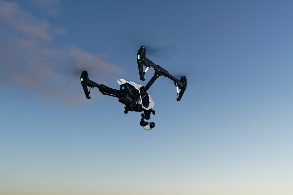
Our drones give us the capability to inspect normally inaccessible areas, providing high resolution imagery for inspecting you or your client’s assets. We can also provide live video feeds accessible to anyone with an internet connection.
Thermal
From missing persons to heat loss reports, our thermal drones provide a new dimension of photography. Find out how thermal imaging can benefit you or your client today.
Architectural Drawings
We can provide as-built drawings, HMOs, location plans, block plans, planning permissions, building warrants, boundary disputes, and more. We have a unique connection with the industry, with more than 15 years of experience.
We can provide Aerial Footage or
Photos for the following:
- Landscape Architects
- Over Water Inspections
- Solar Panel Inspections
- Wind Turbine Inspections
- Printed 3D physical models
- Earthworks including cut & fill
- Golf Course marketing footage
- Legal Boundary Plotting / Disputes
- Filming Businesses at work
- 3D Point Clouds and triangulated mesh
- Land and Property Sales or Purchases
- Topography Mapping, inc .dxf, .dwg& .pdf files
- Stockpile Management & Volumetric Calculations
- Create 3D models for Site Planning and Monitoring Progress of Projects
- Thermal Camera for Heat/Energy Loss, Locating Person/s or Animals, Security
- Aerial Photos to accompany applications or proposals eg. Planning. Infrastructure.
- Surveying of high buildings, roofs & structures which are costly and dangerous to reach
- Survey and provide Data for third parties for use in Autodesk Civils software along with other software
As a smaller independent company, we understand just how important customer service is, and we treat all of our clients from large companies to individuals with the same courtesy. You can be assured that you will only receive the highest level of service from SR Aerial Drone Services. Your data will be delivered on time and at a rate that is highly competitive – so why not get in touch to see what we could do for you?
Land and property sales or purchases
Landscape architects
Building surveyors
Lawyers for title deeds
Earthworks cut & fill
Architects
Civil & Structural Engineers
Land surveyors
Boundary plotting and disputes
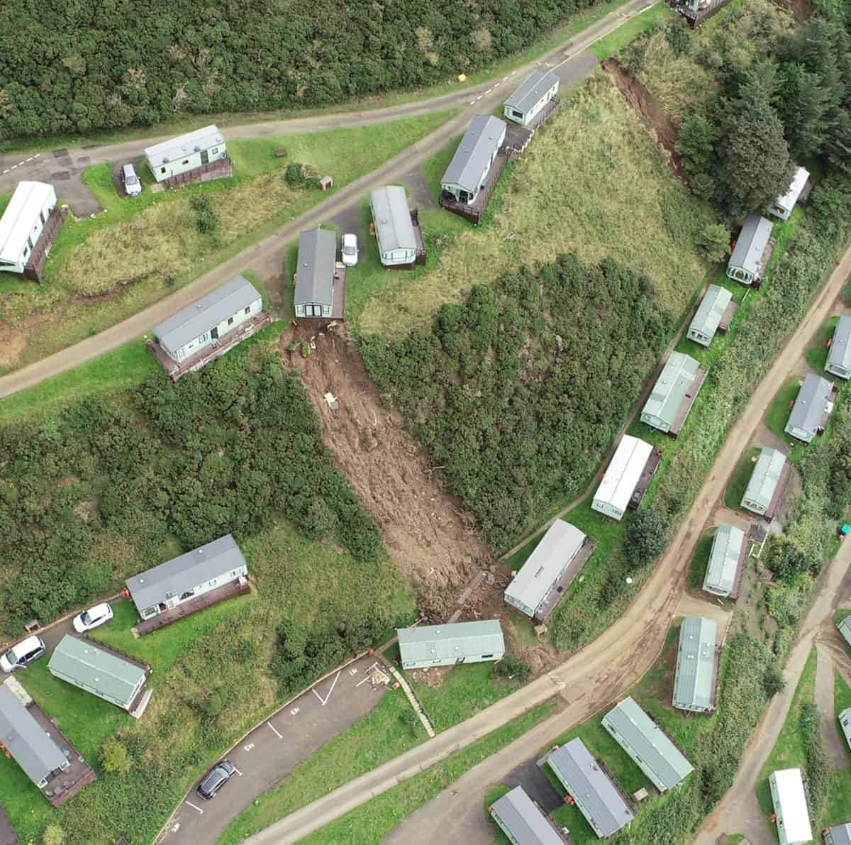
Damage limitation footage
Road and pavement conditions
Sea defences
Work in progress
Media companies
Developers with planning applications
Video editing with text & music overlays
Events photography/videography
Company promotional videos
Hotels, Lodges, holiday Parks
Fragile roofs & structure
Surveyors of all types
Plastic pollution
Costal erosion
SEPA
Land Management
Landfill
Forestry
Local council authorities
Marketing & Web content
Highway infrastructure
Vegetation encroachment
Insurance companies
PR
Construction
Transportation
Solar farms
Land drainage
Property portfolios
Advertising agencies
Hydro Electric Dams
National heritage
Conservation
Fire damage
Structural retaining walls
Mine working subsidence
Structural collapses
Archaeology sites
Tethered drones & cameras
GIS Plotting
Orthomosaics within AutoCad
Facility managers
land drain contractors
Properties developers
Government departments
S.u.d.s – ponds – irrigation
Viaducts & Bridges
Fully Qualified, Approved and Insured
CAA Approved
We are approved for Commercial Operations, Authorised by the Civil Aviation Authority (CAA) for day and night time flights, we hold a current Operational Authorisation (OA) PDRA-01.
Insurance
We are fully insured by coverdrone, the amount of cover can be changed to suit the requirements of the client based on the requirements of their site.
Drone Safe Register
We are members of Drone Safe Register, the UK’s network of approved Commercial Drone Operators.
